Be Your Own Google Mapper
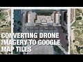
Google Maps is one of the modern wonders of the world. It is hard to remember how expensive it used to be to get high-quality aerial images. Of course, you don’t get to pick when they fly over a particular piece of the planet. If you are like [Dennis Baldwin] that’s not good enough. He’s been using his drone to document the construction of a high school stadium.
[Dennis] uses the open-source GDAL tools to create Google Map tiles from drone imagery. Even better, he’s documented the process in the video you can find below. Once you can make your own map tiles, you can control when you take the images — important if you are documenting construction like [Dennis] did.
[Dennis] knows there are more automated ways to do the mapping, but he wanted to understand the whole process. He also plans on redoing the workflow completely using Open Drone Map. If you want to see some very expensive (non-open source) mapping software at work, you might want to read about this mapping drone.
Filed under: drone hacks

from Hackaday http://ift.tt/2hp91R3
via IFTTT