1922 Industrial Map of New York City @mfgday #MFGDay18

via Slate
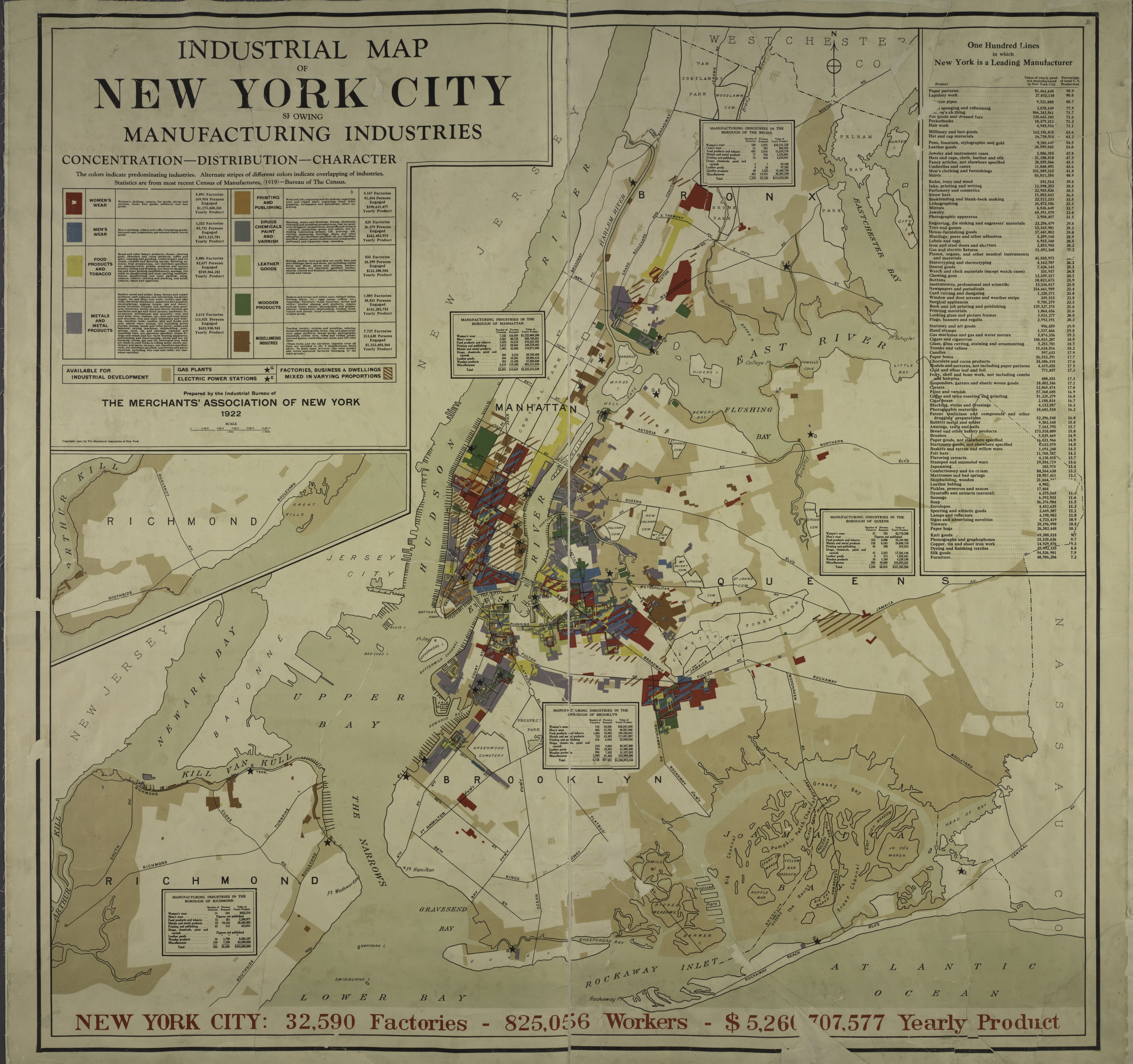
This map, printed by the Merchants’ Association of New York in 1922, shows industrial activity in the city, as reported to the 1919 Census of Manufactures. The map was meant as a promotional tool—beige areas represent areas “available for industrial development”—and to boost the city’s profile in the larger business community.
Geographer Richard Harris, writing about industry in the city between 1900-40 in the Journal of Historical Geography, points out that because of the particular products New York was known for (lapidary work, women’s clothing, millinery), many industrial workers were women. In 1939, they represented 36 percent of the total workforce. Workers in Lower Manhattan, where many garment factories were located, were particularly female.
from Adafruit Industries – Makers, hackers, artists, designers and engineers! https://ift.tt/2pBQJ4p
via IFTTT